Which Denver Neighborhoods Are Actually at Risk from Flooding and What Insurance Costs in 2026
Fall is typically when Denver's real estate market quiets down, but buyers closing right now are confronting something the spring crowd largely missed: title reports flagging FEMA flood zone design…

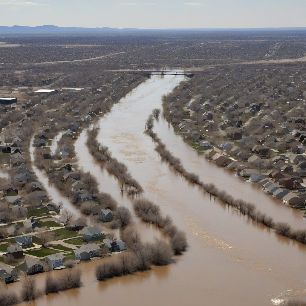
Fall is typically when Denver’s real estate market quiets down, but buyers closing right now are confronting something the spring crowd largely missed: title reports flagging FEMA flood zone designations on properties that Zillow’s climate-risk summary never mentioned. Or properties that Zillow flagged, only to have their designation quietly revised. Late-season convective storms across the Front Range in 2026 have put flooding back in the local conversation, and the timing is bad for anyone mid-transaction who doesn’t know how to read a flood determination letter.
This piece is not general flood education. It’s a buyer’s guide with real Denver numbers, specific neighborhood geography, and a walkthrough of the tools and processes that actually move the needle before you sign closing documents. The South Platte basin remapping completed by the Urban Drainage and Flood Control District over the last two years has changed some parcel-level designations. Older data — including the snapshots that third-party real estate platforms cache — is now wrong in both directions on specific streets. That’s the news. Here’s what you need to know.
The Denver Neighborhoods That Carry Real Flood Risk
Denver’s flood geography follows its drainage infrastructure. Drainage infrastructure follows topography. If you don’t know which watersheds run through a neighborhood, the risk profile doesn’t make sense — and most buyers don’t know, because nobody tells them until they’re three weeks from closing.
Globeville and Elyria-Swansea sit at the lowest elevations in Denver, at the confluence of the South Platte River and its tributary drainage network, including the Globeville Lake tributary drainage channel. Zone AE designations — the highest mandatory-insurance tier — have applied to portions of both neighborhoods for decades. They were the focus of UDFCD’s 2021–2023 South Platte River Flood Hazard Area Delineation study, the most detailed modeling the district has produced for this corridor.
The I-70 expansion, which completed major construction through Globeville in 2022, altered drainage patterns in ways that UDFCD’s post-construction modeling has been evaluating since. Some results have fed into FEMA map amendment filings that have not yet become effective FIRM panels. This means the maps buyers are reading now may understate risk on some parcels while overstating it on others — not a comfortable situation if you’re about to sign a purchase agreement.
The FIRM panels covering Globeville and Elyria-Swansea carry the Denver County prefix 08031C. Pull the relevant panels on the FEMA Flood Map Service Center and check the effective date. Any panel dated before 2023 may not reflect post-I-70 construction modeling.
Overland, along the South Platte’s south corridor, carries Zone AE designations tied to the river itself and to the Overland Pond drainage basin. The River Mile redevelopment by Revesco Properties — the largest private floodplain redevelopment project in Denver’s history — has involved a Conditional Letter of Map Revision process with FEMA. A CLOMR is FEMA’s conditional approval of what the flood maps will look like after a proposed engineering project is completed.
For buyers considering property adjacent to the River Mile site, the practical question is specific: Is the parcel within the CLOMR footprint, outside it, or in a transitional zone where current risk may not match what the map shows in five years? Denver’s Community Planning and Development floodplain office can tell you where a specific address stands relative to the CLOMR boundary. You cannot extract that from a map search. It’s probably the single most important phone call an Overland buyer can make before going under contract.
Montbello surprises people. The neighborhood reads as low-risk on most screening tools, and most of it is — Zone X, which carries minimal federal flood-insurance requirements. But First Creek runs through the northeastern portion, and parcels immediately adjacent to that corridor carry Zone AE designations. These show up in lender flood determinations and catch buyers who assumed the whole area was safe.
The Zone AE pockets in Montbello are narrow. They’re real.
Sun Valley, just west of downtown, has South Platte exposure where it touches the river, and the ongoing Sun Valley Neighborhood Plan redevelopment has involved its own UDFCD coordination. The drainage infrastructure improvements tied to that planning process have created the same gap between engineering reality and effective FIRM panels that exists in Globeville — current maps that the engineering community already considers partially outdated.
Barnum and Barnum West carry Zone AE and Shaded Zone X designations along the Bear Creek and Lakewood Gulch corridors. Lakewood Gulch is a tributary that runs east through the neighborhood before reaching the South Platte. The hazard isn’t a river slowly overflowing its banks — it’s a relatively contained channel that can move an enormous volume of water in under an hour during a hard convective storm. If you’ve watched the gulch during a July downpour, you don’t need the engineering explanation.
Harvey Park sits exposed to Bear Creek. Ruby Hill to the South Platte’s western floodplain. Westwood straddles the Sanderson Gulch corridor, with Zone AE designations running along the creek channel — properties within a few blocks of the gulch are in categorically different regulatory territory than properties a half-mile away, a distinction that can mean thousands of dollars a year in insurance costs.
The mechanism is the same in each case: a defined waterway with a modeled 100-year flood profile, a FEMA-mapped floodplain extending some distance on either side of that channel, and parcels that fall in or out of the Special Flood Hazard Area depending on ground elevation relative to the Base Flood Elevation. Thousands of dollars in annual premiums live in that last variable.
Understanding FEMA’s Zone Designations
When a title report or lender disclosure flags a flood zone, it will use one of these categories.
Zone AE is a Special Flood Hazard Area. FEMA has determined there’s a 1% annual chance of flooding — the “100-year floodplain” — and has calculated a specific Base Flood Elevation for the site. This designation triggers the mandatory purchase requirement. If your mortgage is federally backed (FHA, VA, or a conventional conforming loan sold to Fannie Mae or Freddie Mac), your lender is legally required to ensure you carry flood insurance. Federal statute, not lender preference. There’s no negotiating around it.
Shaded Zone X — sometimes labeled “0.2% annual chance flood” — covers moderate-risk areas that would flood in a 500-year event. Federal mandatory purchase requirements don’t apply. Many lenders require coverage anyway by their own internal policy, but buyers here have more room than buyers in Zone AE, and that distinction is worth understanding before you let a lender tell you otherwise.
Unshaded Zone X is FEMA’s minimal-risk designation, outside the 500-year floodplain. No federal insurance requirement. But “minimal risk” is not “no risk” — not in Denver. Convective storms that overwhelm storm infrastructure generate flash flooding on properties with no FEMA designation at all. About 25% of NFIP claims nationally come from properties outside the Special Flood Hazard Area, a figure that lands differently when you consider what a July thunderstorm can drop onto clay soils in under an hour.
FEMA’s Risk Rating 2.0, rolled out in 2022, changed how the agency calculates individual premium rates even within a fixed zone. Before 2.0, your NFIP premium was primarily a function of flood zone and the difference between your floor and the BFE. Under 2.0, FEMA factors in distance to the water source, frequency of smaller flood events, property replacement cost, and foundation type to generate a property-specific rate. Two Zone AE properties on the same block now carry different NFIP premiums. This catches buyers off guard more than almost anything else in this conversation.
How to Look Up Your Specific Parcel Before You Close
Start with the FEMA Flood Map Service Center at msc.fema.gov. The address search will load a Flood Insurance Rate Map panel for your location. Note the FIRM panel number in the upper right — for Denver County, it begins with 08031C, followed by a four-digit panel identifier and a letter version designator. More importantly, note the effective date. If the panel predates 2023 and you’re looking at a property in Globeville, Elyria-Swansea, or Sun Valley, treat the result as a starting point. The UDFCD South Platte study data has been working its way through the federal process and changes the picture on specific parcels.
What loads is colored zones overlaid on a base map. Zone AE is typically shaded in medium blue or tan depending on the viewer version; Zone X is white or very light. If your address sits visually close to a zone boundary, the precise boundary location matters — a lot.
Denver Community Planning and Development maintains a floodplain GIS data layer through denvergov.org that updates on a different schedule than the FEMA viewer and may reflect local engineering data the federal viewer hasn’t incorporated yet. Use both. The city’s Open Data Catalog also offers a downloadable shapefile for parcel overlay if you want to do your own analysis.
Within the FEMA Map Service Center, the “What’s New” overlay shows recently effective or pending map changes — the mechanism for catching revisions that Zillow’s cached risk snapshots won’t reflect.
The step almost nobody takes: call Denver CPD’s floodplain management office before making an offer. Staff there can tell you whether a specific address is subject to a pending LOMA, LOMR, or CLOMR not yet reflected in the effective FIRM. They can tell you whether the property has a history of flooding or drainage complaints in city records, and where it sits relative to any active city floodplain improvement projects. Reach CPD’s Development Services through the inquiry portal at denvergov.org/CPD and ask specifically for floodplain management. Twenty minutes on that call produces information no website search delivers.
When Your Lender Flags a Flood Zone
If you’ve already received a lender flood zone determination letter, here’s what’s required versus what’s negotiable.
If your mortgage is federally backed and your property is in Zone AE, flood insurance is legally required. The mandatory purchase requirement applies to federally regulated lenders and all government-sponsored loan products. The lender will escrow the premium. If you close without a policy in place — which happens when buyers don’t realize the designation applies until late in the transaction — the lender is required to force-place flood coverage on your behalf. Force-placed flood insurance is substantially more expensive than a policy you shop yourself. Get quotes the moment you see a Zone AE flag in your title work, not the week before closing.
For Shaded Zone X properties, insurance is not federally mandated, but some lenders require it by internal policy. If your lender is insisting on flood coverage, ask them to put the requirement in writing and clarify whether it’s a federal statutory requirement or a lender overlay. If it’s the latter, you can push back, and in some cases shop for a lender whose overlays don’t include flood coverage for moderate-risk zones.
One negotiating point most agents fail to flag: if the seller carries an NFIP policy, the buyer can often assume it at closing and inherit the seller’s rating history, including any grandfathered rate. Under Risk Rating 2.0, NFIP premiums can increase no more than 18% per year until they reach full actuarial rate. A seller who has held an NFIP policy for several years may be paying substantially less than what a new policy on the same property would cost today.
Ask the seller’s agent what the current NFIP premium is. Ask whether the policy is assumable. Ask what the full actuarial rate would be. If that gap is meaningful, assuming the seller’s policy can save hundreds of dollars annually — savings that compound every year until the cap is reached. Most buyers never ask.
What Flood Insurance Actually Costs in Denver in 2026
Your homeowners policy does not cover flooding. It’s explicitly excluded, regardless of carrier or premium level. Flood insurance is a separate product, a separate purchase, a separate policy. Buyers who discover water damage after a flash-flood event and file a homeowners claim learn this while on the phone with an adjuster explaining why the claim is denied.
Colorado’s property insurance market is under serious stress in 2026. Several carriers have reduced or exited the homeowners market due to wildfire and hail loss ratios, and premiums have climbed enough to make Denver one of the more expensive major metros for baseline homeowners coverage. That stress is largely irrelevant to NFIP pricing — the National Flood Insurance Program is federally administered, rates set by FEMA, not by state market dynamics. But the crisis directly affects private flood insurance. Some carriers that were aggressive in Colorado two or three years ago have pulled back, narrowing what had been a competitive private alternative to NFIP for many buyers.
For Zone AE properties without an elevation certificate, expect NFIP premiums between $1,800 and $4,500 per year for a single-family home, driven by Risk Rating 2.0 variables — primarily foundation type, distance to the water source, and replacement cost. An elevation certificate demonstrating positive freeboard relative to the Base Flood Elevation can cut that premium. A professionally produced elevation certificate in Denver runs $500 to $1,200 from a licensed land surveyor. If you’re buying in Zone AE and no certificate exists for the property, getting one before you finalize your insurance purchase often pays for itself in the first year.
In Shaded Zone X, NFIP coverage runs roughly $400 to $900 per year for a standard single-family home. Private market alternatives — where available in Colorado — can come in below the NFIP for Zone X properties because private carriers price more granularly than the federal program. Carriers active in the Colorado market in 2026 include Wright Flood, Neptune Flood, and Palomar Flood. Neptune and Palomar are fully private, which matters: their claims and rate adjustments aren’t subject to NFIP’s statutory caps or the congressional-appropriation pressures that have historically disrupted NFIP payouts after major national flood events.
For Denver buyers in Shaded Zone X who want coverage — and given the flash-flood exposure in a high-convective environment, there’s a reasonable case for carrying it even when it isn’t required — get a private market quote before defaulting to NFIP. For Zone AE buyers, private alternatives exist but the comparison is messier. Private policies may be less expensive and offer higher coverage limits, but they don’t carry the federal program’s assumability benefit or FEMA’s backing for catastrophic losses. There’s no obviously right answer, and anyone who tells you otherwise is simplifying.
For buyers tracking the full financial picture in our moving & real estate coverage, flood insurance is one of the line items that most pre-purchase budgets underestimate — sometimes by thousands of dollars annually.
How to Contest a Flood Zone Designation Through a LOMA
If you believe your property has been incorrectly mapped into a Special Flood Hazard Area, a Letter of Map Amendment may apply. The issue isn’t that FEMA’s methodology is wrong — it’s that your specific parcel’s actual ground elevation is at or above the Base Flood Elevation and the FIRM boundary is drawn too broadly.
A LOMA is FEMA’s mechanism for removing a specific property from the SFHA based on site-specific elevation data. It doesn’t change the underlying flood map; it creates a recorded amendment that applies to your parcel. If FEMA approves it, your lender must remove the mandatory insurance requirement.
Hire a Colorado-licensed land surveyor to produce an Elevation Certificate establishing the lowest adjacent grade and the lowest floor elevation relative to the Base Flood Elevation. Denver-area firms offering this service include Aztec Consultants, Martin/Martin Engineering, and Terracon’s Denver office. Cost: $500 to $1,200.
Submit the LOMA application to FEMA along with the elevation certificate. No application fee for an individual LOMA. Processing runs 60 to 90 days from receipt of a complete application. If FEMA approves it, you receive a Letter of Map Amendment to provide your lender, who is then required to remove the mandatory flood insurance requirement. You don’t lose the coverage if you choose to keep it — and given what Zone X premiums cost, many homeowners with approved LOMAs elect to keep voluntary coverage anyway.
A LOMA differs from a LOMR, which is used when a mapping error affects multiple properties and requires a full engineering study. LOMRs are for developers and neighborhood coalitions addressing systematic mapping issues. Individual buyers use the LOMA process. The cost difference is real: a LOMR can run $3,000 to $10,000 or more in engineering fees; a LOMA costs the price of an elevation certificate.
If your closing is 30 days out, a LOMA can’t be processed in time to satisfy the lender’s insurance requirement. File the application anyway, but purchase flood insurance at closing and give the lender the application receipt. If the LOMA is approved after closing, cancel the policy. You’ll pay two or three months of premiums in the interim — an inconvenience, not a reason to skip the process.
The South Platte Remapping Context and What’s Still Pending
The UDFCD’s 2021–2023 South Platte River Flood Hazard Area Delineation study is not itself a FEMA map change. It’s an engineering data layer — the technical foundation that precedes official map amendments. UDFCD conducted updated hydrologic and hydraulic modeling of the South Platte corridor from roughly the Overland area through Globeville, incorporating post-construction conditions from the 2022 I-70 expansion, changes to channel capacity, and updated precipitation frequency estimates.
The revised flood hazard boundary that emerged doesn’t match the current effective FIRM in several portions of the corridor. In some locations, the new modeling shows higher-than-mapped risk. In others, revised channel geometry post-I-70 has actually reduced modeled flood extent compared to the pre-construction FIRM. Buyers relying solely on the current FIRM panel to evaluate risk on a specific Globeville or Sun Valley parcel are working with data that the engineering community already considers outdated.
The translation from UDFCD modeling to an effective FEMA map change moves through a defined federal process: submission to FEMA as a LOMR or FIRM revision, a proposed map, a community appeal period, then an effective date. Some South Platte study areas are somewhere in that pipeline as of late 2026. Some changes have already become effective; others are still pending.
For the River Mile development in Overland, the Revesco Properties CLOMR represents a separate track — FEMA’s conditional approval of a future map revision contingent on construction being completed as engineered. If the CLOMR process concludes and construction is finished, flood zone boundaries in that portion of the Overland corridor will change. Whether that’s favorable or unfavorable for a specific parcel depends entirely on where it sits relative to the engineered flood control infrastructure being built.
There’s only one way to know where a specific parcel stands relative to all of this — the South Platte study, pending FIRM revisions, the River Mile CLOMR: call Denver CPD’s floodplain management office with the parcel address before making an offer. That office has access to the UDFCD study data, knows which map amendments are in the pipeline, and can tell you whether a given address sits in an area of active revision. No website, no third-party risk platform, no map search will get you there, because none of them track pending FEMA submissions and study data that hasn’t yet been incorporated into an effective panel.
If you’re buying in Globeville, Elyria-Swansea, Sun Valley, or anywhere adjacent to the River Mile footprint in Overland, that call is not optional. Twenty minutes before you waive an inspection contingency is worth considerably more than discovering mandatory flood insurance on a property you thought was in Zone X. Buyers who want a fuller pre-close checklist should also review what Denver home inspectors flag most often, since drainage and foundation issues frequently surface alongside flood-zone concerns.
CityDesk Denver will update this piece as additional South Platte map amendment effective dates are confirmed. Readers with specific parcel questions are encouraged to contact Denver CPD’s floodplain management office through the Development Services portal at denvergov.org/CPD before closing.