Denver's Inversion Season Is Starting. Here's What It Actually Does to Your Lungs.
Mid-October through February, cold air traps PM2.5 over the South Platte valley. Here's which neighborhoods get hit hardest, what the AQI numbers actually mean at 5,280 feet, and how to get alerts …


Mid-October through February, cold air traps PM2.5 over the South Platte valley. Here’s which neighborhoods get hit hardest, what the AQI numbers actually mean at 5,280 feet, and how to get alerts before conditions turn dangerous.
This piece publishes before the first major stagnation event of the 2025–2026 inversion season. Intentionally. Every winter, Denver runs the same cycle: conditions deteriorate, a brown haze settles over the basin, local TV stations issue the same generic “avoid outdoor exercise” advisories, and residents scramble to figure out what that actually means for them. By the time the first CDPHE Action Day is declared, it’s too late to set up alerts, understand the thresholds, or know whether your neighborhood is getting hit harder than the one across town.
This is the guide you should have before that day arrives.
The Geography That Makes Denver’s Winters Chemically Interesting
Denver sits at the bottom of a bowl. The Rocky Mountain Front Range rises immediately to the west, and the South Platte River valley cuts northeast through the city and into Adams County — the lowest terrain in the metro. On clear summer days with strong westerly flow, that geography is spectacular. In winter, it’s a pollution trap.
Here’s the mechanism: On calm, cloudless winter nights, cold dense air drains downslope from the foothills and pools on the valley floor. Cold air is heavier than warm air. Winter high-pressure systems suppress the vertical mixing that would otherwise break up this stratification, so the cold air just sits there. A warmer air mass settles on top of it — what meteorologists call a temperature inversion, where the normal atmospheric pattern flips: cool near the ground, warm above. The cold air stays pinned beneath the warmer layer like a lid.
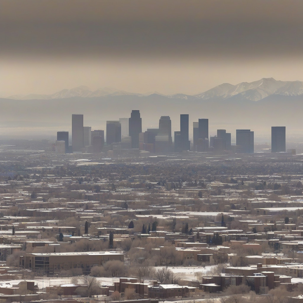
That lid typically sits somewhere between 5,500 and 6,500 feet during severe events. Denver proper is at 5,280 feet, which means the city stays trapped inside while people in foothills communities at higher elevations are literally above the pollution layer. You can see this from I-70 heading into the mountains: look back toward the city and the basin is gray-brown while the sky above you is blue. It’s a striking visual, and a grim one once you understand what you’re looking at.
Everything emitted at ground level stays there. Vehicle exhaust, diesel from the rail yards, industrial stack emissions, wood smoke from residential fireplaces — none of it has anywhere to go. It accumulates. The Rocky Mountain barrier blocks westerly dispersal that would flush the airshed; without a frontal passage to break the inversion, the pollution builds until it doesn’t.
Inversion conditions typically establish in mid-to-late October as nights lengthen and surface temperatures drop. December and January bring the worst stagnation, when solar heating is weakest and high-pressure domes park over the region for their longest uninterrupted stretches. February shifts the pattern — more frontal passages arrive, inversions grow shorter and less intense. By late February it’s a different season. You take what you can get.
PM2.5 Is Not Ozone and That Distinction Matters More Than You Think
Denver residents who pay attention to air quality tend to learn about ozone first. The summer ozone problem is real and gets significant media coverage. But ozone and winter inversion pollution are entirely different problems, and conflating them is probably the most common mistake I see people make when they talk about Denver air quality.
Ozone is photochemical. It forms when nitrogen oxides and volatile organic compounds — from vehicles, oil and gas operations, industrial sources — react in sunlight and heat. Ozone peaks May through September, on hot sunny afternoons. Summer problem.
Inversion-season pollution is PM2.5: fine particulate matter with a diameter of 2.5 microns or less. These particles aren’t formed photochemically. They’re direct combustion products emitted from vehicle exhaust, diesel engines, wood burning, and industrial sources, then concentrated by the trapped airshed. PM2.5 doesn’t need sunlight to accumulate. It can build on a gray, overcast December day with temperatures in the 30s. The brown cloud over Denver in January doesn’t care that it’s cold.
The health implications diverge sharply. Ozone causes airway inflammation — it irritates and damages the bronchial lining, triggering symptoms that resemble asthma. Effects are largely respiratory, which is why summer guidance focuses on peak ozone hours and workout timing.
PM2.5 penetrates deeper. At 2.5 microns, these particles bypass the upper airway filtration and reach deep lung tissue where gas exchange happens. From there, the finest particles enter the bloodstream. The cardiovascular risk from PM2.5 is well-documented and, for certain populations, exceeds the respiratory risk: PM2.5 is associated with increased rates of heart attack and stroke, particularly in people with pre-existing cardiovascular disease. For a lot of Denver residents, winter PM2.5 is more dangerous than summer ozone. It just gets a fraction of the coverage.
A runner who has learned to limit outdoor miles in July, ahead of afternoon ozone spikes, hasn’t solved the winter problem. The person who says “it’s not that hot today, ozone should be fine” in January may be standing in an AQI 140 PM2.5 event without knowing it. Sound familiar?
Denver is a nonattainment area for ozone under federal Clean Air Act standards. That carries regulatory consequences for CDPHE and regional planning, but it doesn’t capture the winter PM2.5 problem. That gets tracked and regulated separately. Knowing which pollutant is active in which season is the foundation for making any informed decision about when outdoor activity is actually safe.
Where It’s Worst During an Inversion
PM2.5 isn’t distributed evenly across Denver during an inversion. Elevation, proximity to major emission sources, and monitoring data all point to the same geography: the lowest sections of the South Platte corridor get hit hardest.
Globeville (80216), Swansea/Elyria (80205), and Sun Valley (80204) occupy some of the lowest elevations in the metro, directly inside the South Platte River valley. They carry a compounding burden. They’re already in the deepest part of the inversion trap, and they sit adjacent to the metro area’s densest cluster of emission sources. Within a few miles: the I-70/I-25 interchange (one of the heaviest diesel freight corridors in the region), rail yards, and Suncor Energy’s Commerce City refinery (80022), among the largest industrial point sources on the Front Range. On a calm inversion day, the airshed fills with accumulated exhaust from tens of thousands of vehicles. Industrial emissions stay trapped at surface level. CDPHE monitoring stations in these corridors have documented measurably higher PM2.5 readings during inversions compared to stations in higher-elevation neighborhoods.
The contrast with Washington Park or Platt Park — higher terrain south of downtown, farther from the industrial corridor — is real and measurable. During mild events the gap in absolute AQI terms may be modest. During severe stagnation, it matters. The difference between an Orange-range reading and a Red-range reading is clinically significant.
EPA EJScreen data for Globeville and Swansea/Elyria places these census tracts in the top percentiles for combined environmental burden — ranking high on both traffic proximity and PM2.5 exposure simultaneously. These are majority-Latino, lower-income communities with less capacity to seal homes against outdoor air infiltration, less likelihood of working remotely when outdoor conditions turn dangerous, fewer resources to retrofit homes with high-efficiency filtration. The geography of inversion pollution in Denver is an environmental justice issue with decades of documented history. It also tends to get three paragraphs of annual coverage and then everyone moves on to the next story. Worth naming that directly.
Residents in foothills communities at higher elevations — Morrison, Evergreen, parts of Golden — are sometimes above the inversion layer during severe events. You can literally see the brown cloud from the mountains looking back toward the city. But during the worst stagnation the inversion layer rises and can engulf these communities as well. Monitor conditions using the same tools as the rest of the metro.
What PM2.5 at 5,280 Feet Does Differently
Healthy Denver residents operate at a baseline blood oxygen saturation of roughly 95–96%. At sea level, normal baseline is 98–99%. That gap is physiologically real. Denver residents acclimate over time, but acclimation doesn’t erase the baseline reduction — it means less respiratory reserve before air quality insults become clinically significant.
UCHealth and Denver Health pulmonologists note this explicitly in patient guidance for asthma and COPD. The national AQI thresholds were developed around sea-level respiratory physiology. They remain the official benchmarks, but their application to a population already breathing at altitude should account for reduced reserve. For COPD patients at Denver Health, written action plans tied to AQI thresholds are standard of care. Pre-emptive bronchodilator use begins on Action Days. Patients have specific triggers for when to stay indoors and when to call. Infants, elderly residents, and people with cardiovascular disease face the greatest PM2.5 risk. The altitude factor amplifies risk across all groups, including healthy adults who rarely think about it.
In our health and wellness coverage of Denver’s seasonal challenges, the inversion season consistently stands out as the period when outdoor-activity guidance requires the most careful calibration for residents at altitude.
Your Tiered Action Guide: Green Through Red
The following applies to inversion-season PM2.5 readings. At Denver’s elevation, the effective impact at any given AQI level exceeds sea-level impact. Keep that in mind when an “acceptable” number looks borderline.
Green (AQI 0–50): Normal outdoor activity for everyone. Run the Cherry Creek Trail. Open the windows. No restrictions.
Yellow (AQI 51–100): Safe for healthy adults. People with severe asthma or advanced COPD should begin moderating intensity and duration of outdoor exercise. This isn’t yet an Action Day, but if conditions are trending toward Orange, prepare accordingly.
Orange (AQI 101–150): CDPHE Action Day territory for PM2.5. All sensitive groups — children, elderly, anyone with respiratory or cardiovascular disease — should limit prolonged outdoor exertion. Healthy adults can exercise outdoors but should reduce intensity and duration. If you’re doing structured training, move it inside. Wood-burning restrictions for older non-certified stoves and decorative fireplaces take effect.
Red (AQI 151–200): Unhealthy for everyone. Sensitive groups stay indoors, windows closed. Healthy adults limit outdoor exertion.
Above 200: Very Unhealthy (201–300) and Hazardous (300+) events are rare in Denver but have occurred. Everyone stays indoors. No exceptions for sensitive-group individuals.
To directly answer what runners are searching: On Green and most Yellow days, yes, go outside. On Orange, move the workout inside or cut it to a short low-intensity walk. On Red days, don’t run outside. The particulate burden during a Red inversion event exceeds what any healthy respiratory system should process at altitude. The fitness gain from one outdoor workout does not offset that. For a practical breakdown of exercising outside when Denver’s air quality deteriorates, including how ozone and PM2.5 seasons require different adjustments, that guide covers the full year.
The Wood-Stove Rule Most Denver Residents Don’t Know
On CDPHE Action Days for PM2.5, residential wood burning is restricted. Most Denver residents either don’t know this or discover it during a cold snap after they’ve already started a fire. Every year. Like clockwork.
The rule: on declared Action Days, older wood stoves that aren’t EPA-certified and conventional decorative fireplaces are prohibited. EPA-certified wood stoves may have limited exemptions depending on the specific declaration — confirm with CDPHE’s current guidance each season, because the specifics can shift. Residential wood burning is a measurable PM2.5 contributor. A neighborhood of homes burning wood on a calm cold inversion night adds fine particulate matter to a sealed airshed. The aggregate effect is real and it worsens the air you and your neighbors are breathing.
Know your device classification before October. Check whether your fireplace insert or wood stove has an EPA certification plate. If you have an older non-certified unit, plan for cold Action Days without it.
How to Check Real-Time Air Quality and Get Alerts Before You Need Them
CDPHE Air Quality Forecast Page (cdphe.colorado.gov/air-quality) is the official source for Colorado monitoring network readings. Action Day declarations originate here. Check this for the official forecast — particularly the day-before forecast, which triggers Action Day declarations — before making exercise decisions.
AirNow.gov handles quick ZIP code lookups and the official AQI color display. It uses the same monitoring network data as CDPHE. Fast and useful, but less granular than community sensor networks for neighborhood-level differences.
PurpleAir (purpleair.com) runs a network of lower-cost community air sensors giving hyperlocal real-time readings beyond what the official network captures. During an active inversion, comparing the PurpleAir sensor in Globeville against one in Washington Park shows the neighborhood disparity plainly. PurpleAir sensors are not regulatory-grade monitors. Use them for directional comparison and trend tracking, not as the authoritative number.
IQAir is popular with runners and cyclists for its interface and hourly forecast display. It pulls from both regulatory monitors and community sensors and is useful for planning workout windows around hourly conditions.
EnviroFlash — Sign Up Now, Before the First Action Day
EnviroFlash (enviroflash.info) is the specific alert mechanism that most air quality coverage ignores. It’s the most actionable tool on this list.
It’s a free email notification service through AirNow that delivers next-day air quality forecasts and Action Day alerts for the counties you select. To sign up: go to enviroflash.info, create a free account, select Denver, Adams, Jefferson, and Arapahoe counties. You’ll receive email alerts when the following day’s forecast crosses whatever AQI band you specify — Yellow if you have a respiratory condition, Orange if you only want Action Day alerts. You’ll know in advance, not after you’ve already laced up at 6 a.m. Whether SMS alerts are available directly through EnviroFlash should be confirmed at the site; that functionality has been intermittently available.
Sign up today. The first major inversion event of the season doesn’t send advance notice.
Before the Brown Cloud Arrives
Denver’s outdoor recreation culture is built around the assumption that the air is good. Most of the time, it is. But every winter, for roughly four months, the same Rocky Mountains that make this city worth living in also seal its pollution against the valley floor. That’s not a metaphor — it’s fluid dynamics, and it plays out the same way every year.
The residents who fare best are the ones who understand the mechanism before the first Action Day is declared. They know which app is open on their phone at 6 a.m. They know whether their wood stove is EPA-certified. They know their 80216 zip code sits lower in the inversion trap than a friend’s house in Platt Park. They’ve already got the EnviroFlash alert set.
Signup takes three minutes. The first severe inversion of 2025–2026 will arrive sometime between now and January, and it will not announce itself the day before.
CityDesk Denver health and environment coverage is based on CDPHE air quality data, EPA monitoring records, EPA EJScreen environmental justice data, and interviews with Denver-area clinicians and public health officials. Specific 2024–2025 Action Day counts, named clinician quotes, and CDPHE monitoring station addresses were flagged for pre-publication verification.