What Denver ER Doctors Want You to Know About Heat Exhaustion Before You Hike This July
---

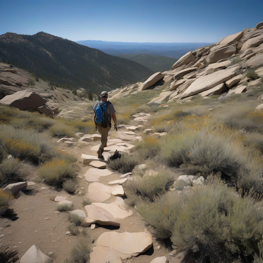
On a Saturday afternoon in mid-July, a family from Houston parks at the Echo Lake trailhead off Highway 103 and starts up toward the Mount Blue Sky summit road. They drove straight from Denver International Airport that morning, grabbed sandwiches at the Idaho Springs McDonald’s, and figured the cool mountain air would make for an easy afternoon. By 1:30 p.m., one of them sits down on a rock and says he feels sick to his stomach. Head pounding. A little foggy about whether they’ve been walking for 20 minutes or an hour.
Healthy 38-year-old man. This matters.
His family does what most people do: assumes altitude sickness. They hand him water, find a flat rock with partial shade, and wait it out. You’d see the same reasoning across a dozen trail forums. Give it time. Drink water. Let the body adjust.
That’s not what this is.
This scenario — or some close version of it — shows the exact risk pattern that emergency physicians and wilderness medicine researchers have identified on Front Range trails in July. Heat exhaustion at altitude, misread as altitude sickness, with the delay doing the damage. Not because people are reckless. Because heat exhaustion at altitude doesn’t look or behave the way it does at sea level, and the two most logical diagnoses share enough symptoms that experienced hikers get them wrong regularly. Treating the wrong one, or waiting when you shouldn’t, can kill someone.
This piece isn’t a general heat exhaustion explainer, and it’s not a guide to acclimatization. It’s about what happens when high-altitude physiology and July heat occupy the same body at the same time — why that combination progresses faster, hides better, and responds differently than either condition alone.
Your Cardiovascular System Arrives Already Behind
Before heat enters the picture, Denver’s elevation has already placed a measurable demand on your body. At 5,280 feet, atmospheric pressure runs roughly 17 percent lower than at sea level. Every breath delivers less oxygen, and your heart compensates by pumping harder and faster. Most people don’t feel this at Denver’s elevation, especially after a few days here. It’s happening whether you feel it or not.
By the time you’re on the Mount Blue Sky summit road above Echo Lake, the oxygen deficit approaches 40 percent below sea level. At 14,130 feet, your cardiovascular system is working significantly harder just to keep your organs oxygenated under normal resting conditions.
Add July heat, and the burden compounds in a way that the emergency medicine literature makes surprisingly clear. When your body overheats, it manages core temperature primarily by redirecting blood flow toward the skin — widened vessels near the surface allow heat to radiate outward, sweat carries heat away through evaporation. Both processes demand cardiovascular capacity. The heart has to simultaneously deliver oxygenated blood to working muscles, maintain circulation to the brain and organs, and push extra flow to the skin for cooling. At sea level, a healthy adult has enough cardiac reserve to manage this. At 12,000 feet, that reserve has already been substantially drawn down.
Here’s what gets lost in the usual heat illness conversation: altitude doesn’t just add risk on top of heat the way you’d stack two independent dangers. It changes how heat illness progresses. The buffer between heat exhaustion and heat stroke — the window during which your body can still compensate — is shorter at elevation. A hiker at 12,000 feet who’s sliding into heat illness does not get the same recovery window as the same hiker at 2,000 feet. The warning signs that normally give you time to respond are compressed.
Why Colorado’s Dry Air Lets You Get Into Trouble Before You Know It
Denver’s July relative humidity averages between 35 and 40 percent — significantly lower than the humid-climate cities where most heat illness awareness content is written. That dry air creates a specific problem visitors frequently misunderstand: sweat evaporates almost immediately off the skin. In Houston or Atlanta, a dehydrated, overheating hiker is visibly soaked. The wetness is a cue — to themselves, to people around them — that something is wrong. In Colorado, that same hiker looks fine. Their shirt might show salt rings, but they don’t feel drenched and don’t register the physical sensation of being in distress. Meanwhile, they can be losing substantial fluid through sweat and respiration combined.
At altitude, lower air pressure accelerates respiratory water loss — you exhale more water vapor per breath than you do at sea level. This loss is invisible, almost never factored into the mental accounting people do about hydration.
Blood volume drops with dehydration, leaving fewer resources to simultaneously deliver oxygen and regulate temperature. The altitude-heat combination can reach a dangerous threshold in less than 90 minutes of sustained activity in July afternoon sun. Not because Colorado heat is extreme by national standards — Denver’s July average high runs in the high 80s to low 90s — but because the body’s usual feedback mechanisms become unreliable. Neither the sensation of sweating nor the sensation of thirst tracks actual deficit accurately at altitude. Hikers reach significant dehydration without the experiential warning that would prompt them to slow down or turn around. Thirst response itself is often blunted at elevation.
The Symptom Fork: Heat Exhaustion or Altitude Sickness
This is the question that causes the most dangerous delays on Front Range trails. It’s also a genuinely hard one, which is why people who’ve hiked here before get it wrong.
Acute mountain sickness typically develops 6 to 12 hours after reaching a new elevation. If you drove to Echo Lake yesterday and woke up this morning with a headache and nausea, that’s a plausible AMS timeline. Your body has had time to register the hypoxic environment and produce the inflammatory and vascular changes associated with altitude illness.
Heat exhaustion doesn’t wait 6 to 12 hours. It develops within 30 to 90 minutes of sustained exertion in direct sun at elevated temperatures. If you’ve been on the trail for an hour in July afternoon sun and you suddenly feel nauseated, dizzy, and your head is pounding, that timing points to heat illness — not altitude sickness — regardless of elevation.
The symptom overlap is real: both conditions produce headache, nausea, fatigue, dizziness, and general malaise. Two additional questions help clarify. What were you doing right before symptoms appeared? What happens when you stop, move to shade, and rest?
Heat exhaustion typically appears during or immediately after peak exertion in direct sun. AMS tends to persist or worsen regardless of activity level — rest in shade doesn’t help much. If moving into shade and sitting for 20 minutes substantially relieves your headache and nausea, the heat component is likely dominant. Still feeling as bad or worse after 30 minutes of rest? Altitude pathology — or a more serious heat condition — needs to be considered.
Neither framework fully addresses what happens when both are present simultaneously, which is probably the most common and least acknowledged version of this situation. A visitor who flew in from Charlotte, drove to Mount Blue Sky the next morning, and has been on the trail for 90 minutes in 88°F afternoon sun is a reasonable candidate for both AMS and heat exhaustion at the same time. Someone treating presumed AMS by resting and waiting — the correct response for mild altitude illness — is doing exactly the wrong thing if heat illness is driving or co-driving their deterioration. Every minute of continued heat exposure accelerates the condition.
If symptoms develop within two hours of sustained sun and exertion, treat for heat illness first. Get out of direct sun. Begin active cooling. Descend. You can evaluate for AMS once the heat component is addressed. You cannot undo damage from delayed heat stroke.
| Heat Exhaustion | Altitude Sickness (AMS) | |
|---|---|---|
| Onset timing | 30–90 min of sun/exertion | 6–12 hrs after elevation gain |
| When it appears | During or just after peak activity | Often upon waking or after prolonged stay at altitude |
| Skin | Pale, cool, clammy (or flushed) | Normal to mildly flushed |
| Core temp | Elevated (99–103°F) | Normal |
| Response to shade and rest | Gradual improvement within 20–30 min | Little to no improvement |
| Response to descent | Rapid improvement | Improvement within hours |
| Confusion/altered mental status | Signals progression to heat stroke | Signals high-altitude cerebral edema (HACE) — both are emergencies |
When Heat Exhaustion Becomes Heat Stroke, and What to Do on a Trail
Heat stroke is not simply severe heat exhaustion. It’s a distinct and immediately life-threatening condition defined by a core body temperature at or above 104°F combined with neurological changes: confusion, disorientation, slurred speech, combativeness, seizure, loss of consciousness. You don’t need to have lost consciousness. Confusion alone, in someone showing signs of significant heat exposure, should be treated as a heat stroke emergency.
The timeline between heat exhaustion and heat stroke is shorter at altitude. A hiker who reaches heat exhaustion at 12,000 feet has less cardiovascular reserve remaining than the same hiker at 1,000 feet. This compression — the narrowed window for intervention — is the part of the altitude-heat combination that experienced hikers most consistently underestimate.
At a trailhead with road access: Get the person into a vehicle with air conditioning running immediately. Don’t wait for an ambulance. Drive down. Descending even 2,000 to 3,000 feet rapidly reduces the altitude component. Drive toward the nearest urgent care or emergency room — in the Mount Blue Sky corridor, that’s UCHealth Emergency in Idaho Springs. En route, have someone pour cool water over the person’s neck, wrists, and armpits. Call 911 from the vehicle so dispatch can advise and coordinate.
Mid-trail with cell service: Call 911 immediately if any neurological symptoms are present. Confusion, slurred speech, or unconsciousness is a heat stroke emergency. Dispatch in Jefferson County and Clear Creek County routes mountain 911 calls to a county dispatch center that coordinates with the relevant SAR or emergency services for that area. While waiting, move the person fully out of direct sun. Lay them flat with legs slightly elevated if they’re conscious and not vomiting. Apply cool water to the neck, armpits, and groin — the areas with the highest concentration of surface blood vessels. A wet bandana or rain layer works. Do not give fluids to someone who is confused or unconscious.
In a cell service dead zone: Send the fastest, least-impaired person in your group for help — but do not leave an unconscious or severely confused victim alone. One person stays. The runner goes for the nearest ranger station, trailhead, or point with cell service. Jefferson County Search and Rescue and Clear Creek County Search and Rescue are both reached through 911 dispatch once service is available. On the Mount Blue Sky corridor, the Echo Lake area at the base of the summit road is the best target for reaching help. One clarification worth knowing: a call made from a Colorado mountain area routes to the county PSAP for that location, not Denver’s 911 center. Jefferson County handles much of the lower Front Range and foothills. Clear Creek County handles the Mount Blue Sky area. If your call drops, call back — mountain dispatch centers are accustomed to fragmented calls and will attempt to re-establish contact.
Who Gets Into Trouble Fastest
Not all hikers arrive at the heat-altitude intersection with equal risk. Here’s a frank assessment of who’s most vulnerable and why.
Same-day visitors flying in and going straight to altitude. This is the highest-risk profile on Front Range trails in July, and it’s extremely common. DIA sits at 5,434 feet. A visitor who lands at noon, drives to Idaho Springs, and is on the Mount Blue Sky trail by 3 p.m. has had zero adjustment time and is attempting the highest exertion of their trip at the hardest physiological moment. The insidious part: they often feel fine in the parking lot, which they correctly interpret as a good sign. It isn’t clearance. Absence of immediate symptoms at the trailhead is not the same as being ready for the summit road. Wait at least 24 to 48 hours before attempting high-elevation destinations.
Older adults on cardiovascular or diuretic medications. Beta blockers limit the heart’s ability to increase cardiac output in response to heat load — exactly the mechanism needed to manage the altitude-heat compound. Diuretics reduce circulating blood volume before hiking even begins. Diminished thirst response, common with aging, means fluid deficit accumulates without the warning signal of feeling thirsty. None of this is a reason to stay home. It’s a reason to know what you’re working with and adjust accordingly.
Children under five. Young children have a much higher surface-area-to-mass ratio than adults, meaning they gain heat from the environment proportionally faster. They also can’t accurately report how they feel and will often keep moving because the group is moving. A child’s affect is not a reliable indicator of physiological status. A four-year-old who seems okay in afternoon sun may already be in early heat exhaustion. Watch for quiet, withdrawn, or unusually slow behavior — that’s a signal, not just tiredness.
Front Range locals who are adjusted to Denver but not to 12,000 feet. This one catches people off guard, and I understand why. A Denver resident who hikes regularly at 7,000 to 8,000 feet has genuinely adapted to that range — and carries real confidence because of it. Mount Blue Sky at 14,130 feet, or even the trailhead areas above 11,000 feet, involves a cardiovascular and oxygen demand that’s meaningfully different. Your adjustment to 8,000 feet does not transfer directly to 13,000 feet. “I hike here all the time” applied to an elevation band you don’t regularly hike is a risk that’s easy to miss precisely because it sounds reasonable.
Competitive and fitness hikers who override symptoms. This group knows their body well enough to notice early heat exhaustion and is motivated enough to push through it. They’ve done it before and finished fine. A competitive runner at sea level who pushes through mile-2 nausea and finishes has learned something useful about effort and discomfort. That same runner at 12,000 feet applying the same lesson is on a different slope entirely. Early heat exhaustion symptoms — mild headache, slight nausea, beginning dizziness — are not mental obstacles to overcome at altitude. They are the warning system working.
Four Front Range Sites Worth Knowing Before You Go
Mount Blue Sky / Mount Evans Road (Clear Creek County). Summit at 14,130 feet. Minimal shade above treeline, partial shade below. Cell service unreliable above treeline, typically absent near the summit. Emergency response through Clear Creek County Sheriff and SAR; nearest hospital is UCHealth in Idaho Springs.
The most common mistake here is starting in the early afternoon. July thunderstorms typically build by 1 to 3 p.m., which compresses the safe hiking window to roughly five hours — first light to midday. Hikers who ignore this leave the parking lot in heat and catch storms above treeline. An 11 a.m. turnaround is the standard most Colorado trail guides recommend for summit hikes in July. Lightning above treeline kills hikers in Colorado every summer. That’s not a figure of speech.
The summit road — still widely called the Mount Evans road locally, a name change some longtime Coloradans have accepted more gracefully than others — requires no advance permit or reservation. A day-use fee or America the Beautiful pass covers Echo Lake entry. Parking fills by 8 a.m. on July weekends, which creates its own problem: hikers who arrive at 10 a.m. and park far from the trailhead are adding distance they didn’t plan for in the heat of the day.
Red Rocks Park (Jefferson County). Elevation approximately 6,200 feet, extremely limited shade on the sandstone formations. Cell service generally available. Emergency response through Jefferson County.
The sandstone absorbs and radiates heat significantly — hikers face heat loading from below and beside them, not just from overhead. The most common mistake is assuming 6,200 feet is “not really altitude” and that morning hours are automatically safe. Free to hike; no advance permit required for trail access.
Chatfield State Park (Jefferson County). Approximately 5,430 feet, with shade in some tree-lined areas and long exposed stretches on the western trail sections. Cell service generally reliable. Emergency response through Jefferson County and Colorado Parks and Wildlife rangers.
Chatfield regularly records afternoon temperatures of 95 to 100°F in July. The lower elevation means less altitude compounding, but it doesn’t reduce heat risk — this is a high-heat environment, and the trails on the western sections have extended exposed stretches. Visitors who pack light because “it’s basically Denver” create unnecessary exposure. Entry is $10 per vehicle daily or covered by a Colorado Parks Pass.
Roxborough State Park (Douglas County). Approximately 6,200 feet at the main trailhead, very limited shade on the signature red rock trails, some forest coverage on the Carpenter Peak trail. Cell service unreliable in much of the park due to canyon topography. Emergency response through Douglas County and Colorado Parks and Wildlife.
Most popular trails here are 2 to 3 miles, which leads visitors to pack for 90 minutes instead of for actual July afternoon conditions. No water filling stations on the trails. No dogs allowed. The cell service gaps in the lower canyon sections mean that a call for help from some trail segments simply won’t connect — which makes the “send one person for help” protocol more important here than at the other three sites. Entry is $9 per vehicle.
None of these sites currently require advance permits or reservations for general trail access. Zero friction exists between an unprepared same-day visitor and the trailhead. That’s part of the problem.
What the Sea-Level Prep Advice Gets Wrong About Colorado in July
Standard July hiking advice isn’t wrong. It’s calibrated for a different physiological situation. Here’s what changes specifically in Colorado.
Meaningful physiological adjustment to altitude takes 7 to 10 days. Within the first 24 to 48 hours you gain partial adjustment — enough to function reasonably at moderate elevations — but your cardiovascular reserve at 12,000 feet on day one is substantially lower than on day seven. This is not splitting hairs. It changes how much buffer you have if something goes wrong.
The morning start is a harder rule in Colorado than elsewhere. At sea level, starting before 9 a.m. is good practice for avoiding afternoon heat. In Colorado in July, you’re also racing the afternoon thunderstorm window. In the mountains, that window typically builds between 1 and 3 p.m. Above 11,000 feet in July, plan your turnaround before noon. Not “around noon.” Before noon.
Denver’s UV index regularly hits 10 to 11 — Very High to Extreme — on clear July days, as tracked by the National Weather Service’s UV index forecasts. Sunburn isn’t just uncomfortable; it directly impairs the skin’s ability to regulate temperature. Burned skin is damaged skin, and its ability to conduct heat outward and manage sweat response is compromised. Sunscreen is mechanistically relevant to heat illness prevention, not a separate concern.
A few things standard packing lists consistently miss. A paper map of the trail: cell service in mountain zones is unreliable enough that downloaded offline maps are better than nothing, but a waterproof paper map is the actual fail-safe. Park visitor centers and trailhead kiosks sometimes have them; pick one up before you go above service range. Write down the name and location of the nearest ranger station before you leave cell service — you can drive or carry an incapacitated person to a ranger station faster than waiting for a response team. And save the relevant county SAR contact before you lose service. Jefferson County handles Red Rocks and much of the foothills. Clear Creek County handles the Mount Blue Sky corridor.
If You Need Help and You’re Not Sure You Can Pay For It
Cost fear causes documented delays in emergency response, particularly among out-of-state visitors and uninsured residents who hesitate to call 911 because they’re uncertain what search and rescue or emergency room care will cost.
So this is stated plainly: do not let this stop you.
Denver Health operates as a safety-net hospital and has financial assistance programs for uninsured and underinsured patients. Contact Denver Health directly at (303) 436-6000 for specific information on financial assistance. If someone in your group is in a medical emergency on a Colorado trail, call for help. The window for treating heat stroke closes in minutes. Financial questions can be addressed afterward. For a broader look at how to find primary care before an emergency arises, our health & wellness coverage includes guides to Denver’s medical systems and outdoor safety resources.
The One Thing to Take With You on the Trail
Denver’s July heat is not extreme by national standards. The temperature alone would not put most healthy adults in an emergency room. What creates danger on Front Range trails is the context that heat enters — a cardiovascular system already running at reduced reserve, a hydration feedback system quietly muffled by dry air, and a symptom picture that looks enough like altitude sickness to buy a dangerous delay.
If someone in your group becomes confused, can’t walk a straight line, or is nauseated and getting worse after 20 minutes in shade, those are not altitude adjustment symptoms to wait out. That’s a heat illness emergency. At 12,000 feet, the margin for waiting is not what it looks like.
Descend. Cool the person. Call for help.
CityDesk Denver covers local health systems, outdoor safety, and civic infrastructure in the Denver metro area. Readers with specific medical questions should contact a licensed physician. Denver Health’s main line for general inquiries is (303) 436-6000.